Terrestrial laser scanning & data processing
Our services
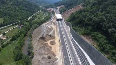
3D laser scanning & data processing
3D laser scanning technology offers a rapid and cost-effective solution for obtaining highly accurate and detailed 3D models of your project’s focal points.
At GEOTAUR, we’re equipped with the expertise and cutting-edge equipment to deliver exceptional results tailored to your project’s size, complexity, accuracy requirements, and level of detail.
Customized Solutions for Your Project
Our experienced team assesses the unique demands of your project to determine the optimal methodology, equipment, and workforce needed for timely, cost-effective, and precise project completion. Drawing from our vast knowledge and experience across diverse fields and industries, we’re committed to finding the most efficient and effective solution that aligns with your goals.
Why Choose Terrestrial 3D Laser Scanning?
Accuracy: Achieve unparalleled precision in 3D modeling.
Detail: Capture intricate details with ease.
Speed: Save time and resources with efficient scanning.
Cost-Effectiveness: Maximize your project’s budget.
Experienced Team: Benefit from our wealth of industry experience.
Tailored Solutions: We customize our approach to your specific needs.
To learn more about our services, please click the “Download” button to access the Geotaur Capability Brochure.
DownloadOur services
Other services we offer

Airborne & Mobile Lidar
GEOTAUR specializes in LiDAR technology, offering comprehensive services for precise spatial data acquisition and processing.
Photogrammetry
Digital photogrammetry aims to establish the geometric relationship between an object and a digital image, deriving essential spatial data exclusively from the image itself.
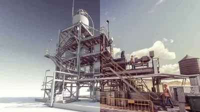
3D modelling & BIM
Using various types of software Geotaur can create an intelligent BIM 3D models with specified level of detail, from LOD 100 to LOD 400.